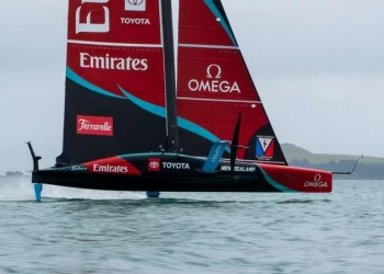
ETNZ: Project Landspeed, positive forecast on the horizon
ETNZ: Project Landspeed, positive forecast on the horizon
The fly in the ointment in the attempt continues to be that the lake and the state of South Australia, and in fact a large amount of Australia has had excessive rain this year, resulting in an uphill battle against the elements for a prolonged stretch of dry salt to let Horonuku fly.
Mount Ive is near the part of the lake where Glenn and the team have based themselves and daily rainfall is measured.
Below is a graph of the 2022 monthly rain for Mt Ive where data can be compared to the long term mean and median, what’s missing with this data is the intensity of the rain – the number of rain days for the monthly average.

As illustrated in the graph, this year kicked off with excessive rain – and the remainder of the year has never really recovered – with regular top ups flowing onto the lake.
In November 2021 and January this year, there were 2 extreme events where Mt Ive had 10 times and twice their monthly average rain. The January rain fell in 3 days with most on just 1day. Those 2 months put excess water in the lake and that water is pushed around by the prevailing wind – several days of pre-frontal N winds pushes the water to the southern end of the lake and the race area while post frontal SW-S winds pushes the water back to the north. Evaporation would normally reduce the amount of mobile water in the lake, but this year, the evaporation has been matched by further rain.
January 2022 was a monthly all-time record, as was November 2021 and August 2022 was close to a monthly record. In summary – the conditions now are a result of the extremely wet last summer and the re-occurring rain throughout this year – never allowing the lake to dry out by evaporation.
So what is next?
The rain over the western half of Australia (including South Australia) is primarily driven by the Indian Ocean measured with the Indian Ocean Dipole (IOD) which is an irregular oscillation of sea surface temperatures and related atmospheric circulations. This has been in a negative phase which tend to favour above average rainfall. That index has changed over the last month to neutral and is now slightly positive indicating that the fronts from the west will have less moisture and rain during summer.
This is not the case for eastern Australia, where the Pacific Ocean remains in the wet La Nina phase. It is then likely that the evaporative process will soon do better than the monthly rainfall. But these condition come with hot summer daytime temperatures.
So the outlook is looking more positive, the land speed team will head back to the lake this weekend to set up for what is hoped will be a couple of weeks of dry lake speed runs in breeze forecast to be 20 knots + to help work Horonuku up closer to the 200km/h mark.


